Strategic Development Regions
Stonewater's infrastructure strategy targets three distinct development regions, each selected for its strategic alignment with Canada's defence manufacturing priorities.
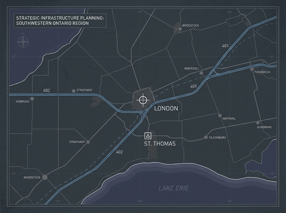
The London–St. Thomas corridor spans approximately 40 km along the Highway 401/402 intersection, connecting Canada's densest concentration of land systems manufacturing to regional logistics infrastructure including London International Airport and multi-modal freight connections.
Southwestern Ontario
Land Systems Manufacturing Corridor
Centred on the London–St. Thomas corridor, this region represents Canada's primary land systems manufacturing base. Stonewater's sites are positioned for direct integration with the GDLS–Canada supply chain and broader armoured vehicle production ecosystem.
Strategic Attributes
- Adjacent to General Dynamics Land Systems–Canada operations
- Highway 401/402 corridor connectivity
- Established defence manufacturing workforce
- Municipal pre-alignment for defence industrial development
- Multi-parcel phased expansion potential
- Rail access availability
12-Month Infrastructure Delivery Model
From strategic agreement to facility occupancy within a single fiscal cycle.
Strategic Alignment
Requirements, site confirmation, municipal engagement
Design & Permitting
Facility design, permits, security architecture
Construction
Site development, structural build, systems installation
Commissioning
Systems commissioning, fit-out support
Occupancy
Production readiness, facility handover